| |
|
|
Individual
Quad
Search
|
|
Custom
Area
Quad
|
|
|
|
|
|
|
|
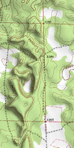
ChartTiff
Interactive
Try our totally interactive geo-graphical interface
for selecting and ordering data.
|
|
|
|
|
|
ChartTiff NextGen Geo's
(USGS GeoPDFs as Geotiffs)
- The Next Generation of ChartTiff's Collarless / Seamless Topo Maps
- Generated from the latest Digitally Generated USGS Topographic Maps
- All Historical Topo Maps also available
- Collars (Legends) removed
- Creates a seamless mosaiced image with adjacent maps
- 1:24,000 Scale Available
- 600 DPI, Selectable DPI of 600, 500, 400, 300, 250
- GeoTiff Format
- Includes ESRI and MapInfo World Files
- In your specified Projection
|
|
ChartTiff NextGen DRG's
(USGS GeoPDFs as Geotiffs)
- The Next Generation of ChartTiff's Collared Topo Map
- Generated from the latest Digitally Generated USGS Topographic
Maps
- 1:24,000 Scale Available
- 600 DPI, Selectable DPI of 600, 500, 400, 300, 250
- GeoTiff Format
- Includes ESRI and MapInfo World Files
- In your specified Projection
|
|
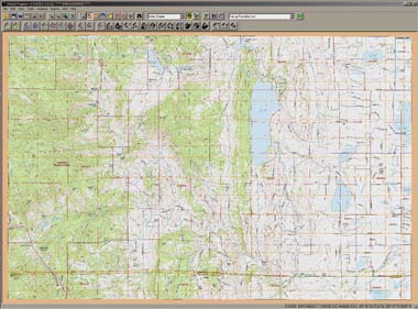
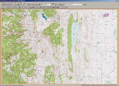
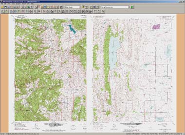
ChartTiff Orignal Geo's in Digital Form, a ChartTiff Standard
- Original USGS Topo Maps with collars (Legends) removed Creates a seamless mosaiced image with adjacent maps
- 250 DPI, GeoTiff Format
- Includes ESRI and MapInfo World Files
- In your specified Projection
|
|
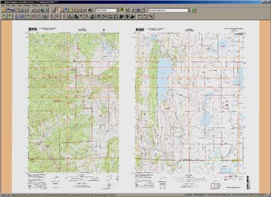
ChartTiff Original DRG's in Digital Form
- Original USGS Collared (with Legends) Topographic Maps
- 250 DPI, GeoTiff Format
- Includes ESRI and MapInfo World Files
- In your specified Projection
|
|
|
ChartTiff Orignal GeoLite's in Digital Form
- Original USGS Topo Maps with collars (Legends) removed Creates a seamless mosaiced image with adjacent maps
- 125 DPI, JPEG Format
- Includes ESRI World File
- In your specified Projection
|
|
|
|
|
ChartTiff 2003 through 2025
NAIP Imagery
- USDA National Agriculture Imagery Program
- Individual 3.75 Minute DOQQs
- 24 Bit True Color
- In Geotiff, 8-Bit Geotiff PackBits, 8-Bit Geotiff Uncompressed,
JPEG or JPEG2000 Formats
- Includes ESRI and MapInfo World Files
- In your specified Projection
|
|
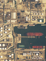
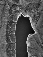
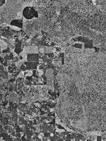
ChartTiff USGS DOQQ Aerial Photos
- Original USGS Digital Aerial Photo Quarter Quadrangle
- Individual 3.75 Minute DOQQs
- Grayscale or CIR (ColorInfraRed)
- In Geotiff, 8-Bit Geotiff PackBits, 8-Bit Geotiff Uncompressed,
JPEG or JPEG2000 Formats
- Includes ESRI and MapInfo World Files
- In your specified Projection
|
|
ChartTiff USGS DOQ Aerial Photos
- Original USGS Digital Aerial Photo Quadrangle
- Individual 7.5 Minute DOQs
- Available in the states
of Oregon, Washington and Alaska
- Grayscale or CIR (ColorInfraRed)
- In Geotiff, 8-Bit Geotiff PackBits, 8-Bit Geotiff Uncompressed,
JPEG or JPEG2000 Formats
- Includes ESRI and MapInfo World Files
- In your specified Projection
|
|
|
|
|
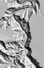
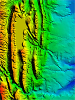
ChartTiff 10 and 30 Meter 3DEP's in Digital Form
- USGS 3D Elevation Program
- The Latest Generation of USGS
Elevation Data for GIS Professionals
- Quads available in: USGS DEM, PLS-CADD,
XYZ Text Formats, C-Tech and ESRI Grid Float
- In your specified Projection
|
|
|
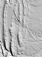
ChartTiff 3,10,30 and 60 Meter NED's in Digital Form
- USGS National Elevation Dataset
- The Next Generation of Elevation Data for GIS Professionals
- Quads available in: USGS DEM, PLS-CADD,
XYZ Text Formats, C-Tech and ESRI Grid Float
- In your specified Projection
|
|
ChartTiff 30 and 60 Meter DEM's in Digital Form
- Original USGS DEM Elevation Models
- Cleaned and Standardized
- Quads available in: USGS DEM, PLS-CADD,
XYZ Text Formats, C-Tech and ESRI Grid Float
- In your specified Projection
|
|
|
|
|
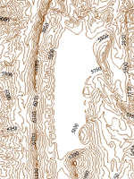
ChartTiff VECTOR Contours in Digital Form
- Derived from the 10-Meter USGS National Elevation Dataset
- Sold by Individual Quad or Custom Area
- Available in: ESRI Shape File and AutoCAD DXF/DWG Formats
- In your specified Projection
|
|
ChartTiff ContourPlus DLG Overlays
- Contours Derived from the USGS National Elevation Dataset
- Now includes the National Wetlands Inventory quad
- DLG Overlays from 1:24,000 or 1:100,000 Scale
- Sold by Individual Quad
- Available in: ESRI Shape File and AutoCAD DXF/DWG Formats
- In your specified Projection
|
|
|
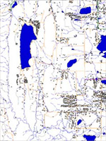
ChartTiff VECTOR Digital Line Graphs (DLGs)
- Digital vector representations of cartographic information derived from USGS maps and related sources.
- Available in UTM, State Plane or Latitude / Longitude Projection
- Available in ESRI Shapefile Format
- Sold by Full Degree Set
|
|
ChartTiff National Wetland Inventory
The US Fish and Wildlife Service (FWS) is the principal US Federal agency tasked with providing information to the public on the status and trends of our Nation's wetlands.
- Includes Wetland and Riparian Layer if available.
- Available from ChartTiff as Individual 7.5 Minute Quads.
- Available in UTM, State Plane, Latitude / Longitude or Web Mercator projection.
- Available in: ESRI Shape or AutoCAD DXF/DWG Formats
|
|
|
|
If you are planning to order over 50 items or have a custom area
Send us the list of quad names or numbers, your area of interest coordinates
or a ESRI shape file and we'll place the order for you.
Please call (xxx) xxx-8769 for assistance.
|
|
|
|
|
|
|
|
|
Introducing 3DEP
Latest USGS 3D Elevation Program !
USGS Latest Lidar based
3D Elevation Program
10 and 30 Meter data available
in your Projection and Format.
Individual Quads, State Sets and Custom Areas.
Click for Details
|
|
Mobile Website !
Specifically designed for the mobile format.
Order any type of data or imagery as individual quads in any projection or option.
|
|
|
Color to Grayscale
conversion option for Topographic Maps !
Convert any
ChartTiff Topo Map to a Grayscale image. Select Option
during Check Out.
|
|
|
|
|
|
|
|
|
|
|
|
Pre-Paid
Download
Subscriptions
|

|
|
You can purchase a subscription to download ChartTiff digital data
at additional savings !!
|
|
|
|
|
|
|
|
|
|
|
|
|
|