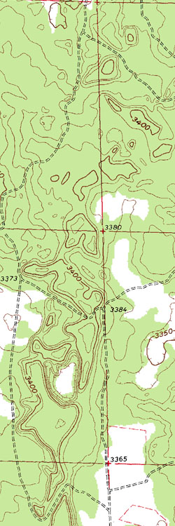
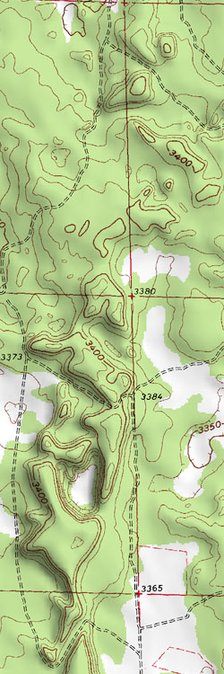
Enhance any topographic map with Shaded Reliefs generated
from the USGS 3DEP Dataset.
A great visual aid to accentuate natural terrain elevations.
|
|
|
-
Shaded Relief Option available for all downloadable:
NextGen Geos, Geos, Custom Area NextGen Geos, Custom Area Geos
NextGen DRGs, DRGs, Custom Area NextGen DRGs, Custom Area DRGs
GeoLites and Custom Area GeoLites
-
Available for all scales of Topographic Maps
NextGen Geos and DRGs only available in 1:24,000 Scale
Geos and DRGs in 1:24,000 -- 1:100,000 -- 1:250,000 and 1:63,360 (Alaska Quads)
-
Simply select the Shaded Relief Option during Checkout
A small charge will be added to your cart once selected
-
Click Here
to view Shaded Topo Map of Grand Canyon Area (3 MB)
-
Click Here
to view Non-Shaded Topo Map of Grand Canyon Area (3 MB)
|
|
|
|
|