ChartTiff Contours   ChartTiff Contours
nav ABOUT QUAD CUSTOM REQUEST
   
  About Contours
 
ChartTiff Contours are derived from the USGS National Elevation Data Set.

ChartTiff Contour quads and custom area Contours are available in a variety of Formats and Projections for easy input into various GIS applications.
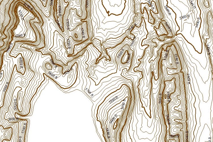
The complete USGS NED Release Notes can be viewed by clicking the following link:

NED Release Notes

The National Elevation Dataset (NED) is the latest product assembled by the U.S. Geological Survey and is updated periodically by the USGS and ChartTiffNED is designed to provide National elevation data in a seamless form with a consistent datum, elevation unit, and projection.  Data corrections were made in the NED assembly process to minimize artifacts, perform edge matching, and fill sliver areas of missing data.

NED data has resolutions of 3,10 and 30 meters in the continuous United States, Hawaii, Puerto Rico and Virgin Islands, resolution of 3,10, 30 and 60 Meters in Alaska and a resolution of 30 Meters in some Canada and Mexico.

NED data sources have a variety of acquisition techniques, elevation units, horizontal datums, and map projections.  In the NED assembly process the elevation values are converted to deci-meters as a consistent unit of measure, NAD83 is consistently used as horizontal datum, and all the data are recast in a geographic projection.  Older DEM's produced by methods that are now obsolete have been filtered during the NED assembly process to minimize artifacts that are commonly found in data produced by these methods.  Artifact removal greatly improves the quality of the slope, shaded-relief, and synthetic drainage information that can be derived from the elevation data.  The figure below illustrates the results of this artifact removal filtering.  NED processing also includes steps to adjust values where adjacent DEM's do not match well, and to fill sliver areas of missing data between DEM's.  These processing steps ensure that NED has no void areas and artificial discontinuities have been minimized.

USGS NED (National Elevation Dataset)

Figure. A shaded-relief representation of the Rockypoint, Wyoming 7.5-minute DEM is shown above on the left.
The same area is shown on the right after NED artifact filtering has been performed.
The super-imposed red lines are synthetic drainage networks derived from each elevation dataset.

National Elevation Data
  • Horizontal Resolution
    3 Meter resolution for Continental US

    Also know as 1/9 Arc Second Resolution
    10 Meter resolution for Continental US
    Also know as 1/3 Arc Second Resolution
    30 Meter resolution for Continental US, HI, PR and VI
    Also know as 1 Arc Second Resolution
    60 Meter resolution for Alaska
    Also know as 2 Arc Second Resolution

  • Vertical Resolution: 1 DeciMeter or 10 CM or approximately 4 Inches.

  • Vertical Datum: NAVD88

  • Vertical Accuracy, See:  USGS NED Accuracy Paper


  • Individual Quads available in:
    ESRI Shapefile format

    AutoCAD (DWG & DXF) Formats

  • Available Projections
    UTM - User Selectable Zones - NAD27 / NAD83 / WGS72 / WGS84
    State Plane - User Selectable Zones - NAD27 / NAD83
    Latitude / Longitude - NAD27 / NAD83 / WGS72 / WGS84
    Web Mercator - WGS84

  • Contour Units (selected during check-out)
    Select 5, 10, 20, 25, 30, 40, 50, 60, 80, 90, 100  Feet / Meters
    Other Intervals available by request
  ChartTiff Contours are NOT available as 1 Free Download

  ChartTiff Contours are sold by: